| Dyer Land &
Cattle Company |
|
|
|
 |
|
|
|
Dyer Land & Cattle Company |
|
|
|
|
Acreage: |
342.00 ±
Deeded Acres |
|
|
620.00 NM
State Lease Acres |
|
|
962.00
Total Acres |
|
|
|
|
Location: |
Approximately 2 miles
southwest of Magdalena, New
Mexico along and on the west
side of State Road 107. |
|
|
|
|
Access: |
State Road
107 along with privately
maintained interior
roadways. |
|
|
|
|
Grazing Capacity: |
The grazing
capacity of the Dyer Ranch
is owner-controlled at the
discretion of the ranch
owner. New Mexico State
University rates the area to be able to
sustain one animal unit on
80 acres on an annual basis.
Total grazing capacity under
normal rainfall is estimated
to be between 12 and 14
animal units yearlong. |
|
|
|
|
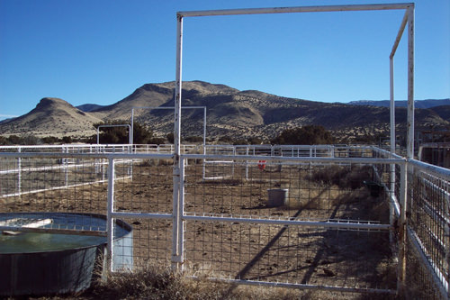
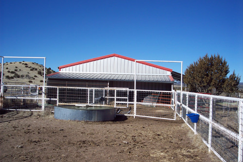
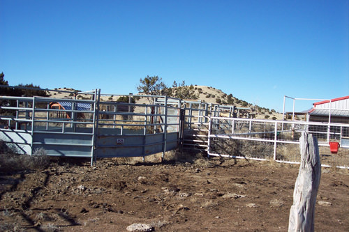
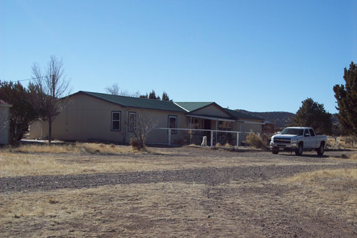
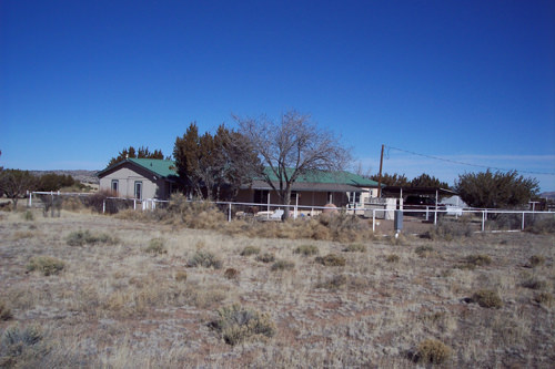
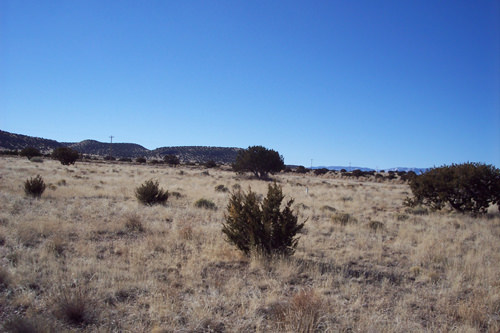
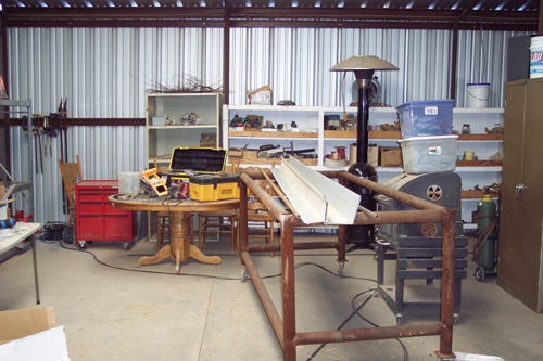
Description: |
This small
ranch unit is ideal for
someone searching for the
rural lifestyle and the
western way of life. The
property is located
approximately 2 miles
southwest of the small
community of Magdalena, NM
along and adjacent to State
Highway 107. The ranch is
partitioned into three
pastures each with a
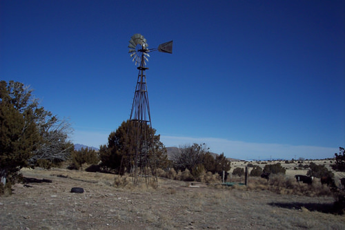
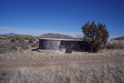
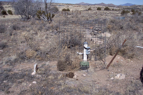
permanent source of water.
Livestock and domestic water
is provided by three wells
and an underground pipeline
system. The wells are
equipped with one windmill
and one electric submersible
pump. One well is currently
not in service. Water depth
varies from 65 feet to 85
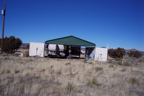
feet. The headquarters is
situated in the center of
the property with a nice set
of cattle working pens of
pipe construction.
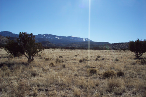
Wildlife in the immediate
area of the ranch includes
mule deer and elk, which on
occasion may be visible from
the front or back porch of
the residence. The Cibola
National Forest is located
just across Highway 107 that
provides public access for
hiking, hunting, horseback
riding and other
recreational activities. |
|
|
|
|
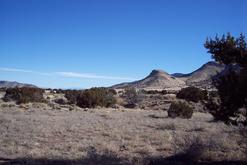
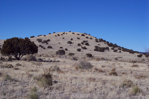
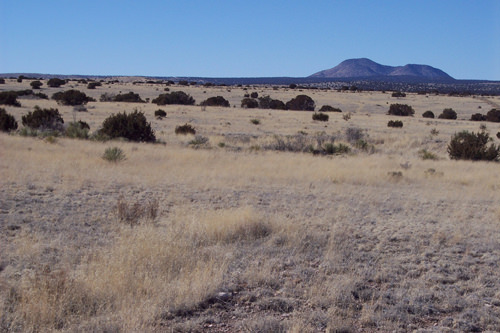
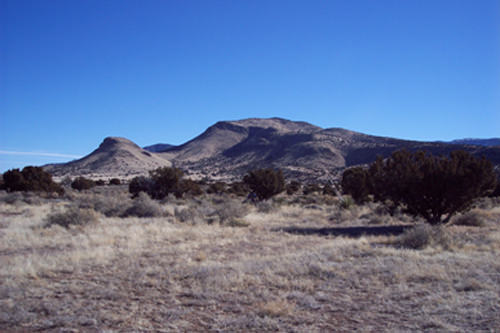
Terrain: |
The terrain
is characterized by extreme
relief, high fault block
mountains of igneous rock
and broad structural basins
such as the Plains of San
Augustine. The ranch is
gently sloping with
intermittent hills and
drainages. The primary
forage includes several
varieties of grama grass.
Tree cover consists of piñon
pine, cedar and juniper,
which provides protection
for wildlife and livestock
during inclement weather. |
|
|
|
|
Area Data: |
The Spanish
exploration of the area that
was to become Socorro County
began with the expedition of
Don Juan de Onate Coronado
in 1540. The expedition
reached the area in June of
1598. Onate gave the name
Socorro, which means aid, to
the Pueblo of Pilabo,
commemoration the food and
assistance given his party
by the natives. The Spanish
colonies were abandoned in
1680 because of hostilities
associated with the Pueblo
Indian Revolt in northern
New Mexico. The Spanish
reconquered New Mexico in
1693, but the town of
Socorro and the surrounding
villages were not resettled
until 1816. Large grants of
land given by the King of
Spain aided in the
resettlement efforts. Two of
these land grants now make
up most of the Bosque del
Apache and Sevillita
National Wildlife Refuges.
Socorro County grew rapidly
in the 1880’s following the
end of the Apache Indian
wars and the arrival of the
Sante Fe Railroad. Rich
mineral deposits in the
nearby mountains allowed
Socorro to become the mining
and smelting center of the
southwest. Livestock
ranching also stimulated
growth in the county. Cattle
and sheep by the tens of
thousands were driven across
the Plains of San Augustine
to the railhead at
Magdalena.
Magdalena
was named by the Spanish for
“The Lady of the Mountain”,
a rock formation on
Magdalena Peak overlooking
the community. Magdalena
continues to be a ranching
community while
strengthening its art,
astronomy and geology
venues. The reopening of the
Magdalena Hotel (circa 1917)
and renovation of other
historical buildings allow
visitors to connect with the
past. The town was known as
the “Trails End” for the
railroad spur line that was
built in 1885 from Socorro
to Magdalena to transport
the cattle, sheep, wool,
timber and ore. Thousands of
were driven into town
(cowboy style) from the west
utilizing the historic
“Magdalena Trail”. This
stock driveway was used
annually from 1885 through
1916 when the driveway was
officially designated by law
through the signing of the
“Grazing Homestead Act”. It
was continually used until
1971. The original
stockyards are still intact. |
|
|
|
|
Price: |
$650,000.00 |
|
|
|
|